SAMS

Televiewer OPTV and ATV

Televiewer OPTV and ATV

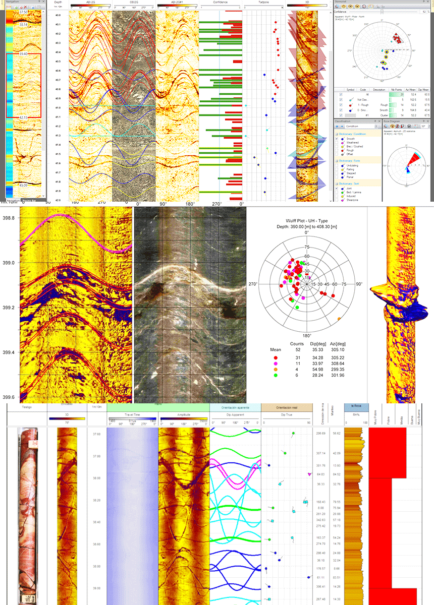
En SAMS ofrecemos el servicio de Televiewer OPTV y ATV, una solución avanzada que permite obtener imágenes continuas, orientadas y de alta resolución de las paredes internas del pozo. Esta tecnología proporciona un mapeo estructural y litológico de precisión milimétrica, facilitando la identificación detallada de vetas, fracturas, foliaciones, contactos y otras discontinuidades clave para la evaluación del yacimiento.

El OPTV (Optical Televiewer) genera una imagen en color de 360°, ideal para formaciones donde las condiciones ópticas son favorables. Por su parte, el ATV (Acoustic Televiewer) utiliza ondas ultrasónicas que permiten operar con fiabilidad incluso en pozos con fluidos turbios o lodos de perforación, asegurando continuidad de datos en diversos entornos.

Los registros obtenidos —completamente orientados y magnéticamente corregidos— se integran de manera directa a los modelos geológicos, geotécnicos y de diseño de mina. Esto se traduce en mayor confiabilidad operativa, reducción de riesgos de interpretación y una optimización sustancial en la toma de decisiones durante la exploración y planificación minera.

animacion-de-pantallas-de-televiewer
services_sing

3 Key Benefits

View full structural well

Thanks to the continuous image of 360° of the borehole wall, you can identify fractures, the planes of foliation, contacts, lithological and cavities, even in areas of recovery of witness poor. For example, the OPTV shows planes intersecting as a winding path in the image displayed.

This visualization allows for the analysis of “critical areas” before you move forward on development, or stop by unexpected risks.

The technology of ATV allows you to operate in areas where the well is full of mud, murky water or drilling fluid, where the optical (OPTV) is not viable. 
This ensures that even in complex holes, we obtain log fracturing, actual diameter of the well (caliper), and orientation to magnetic-completed, reducing operational uncertainty.

Logs are oriented from the well was used to feed the structural modeling, generate diagrams of poles, maps of discontinuities and correct the geometry of the rock mass based on actual data.

This mode optimizes the design of slopes, galleries or tunnels, and improves the forecast in the continuity of the deposit, which has a direct impact in saving time and cost in drilling campaign.

How can we help you?

If you need help, do not hesitate to get in contact with us.

Download brochure digital

Social networks